
Frankfort ZIP Directory Coverage
Official USPS assignment material groups Frankfort mailing ZIPs in two runs. It does not define a neighborhood for each code, and it does not prove that every address is inside the incorporated city. The careful Frankfort ZIP code directory therefore records only the documented grouping and sends each final address to USPS verification.
| ZIP | Documented coverage | Post office | Directory note |
|---|---|---|---|
| 40601 | Frankfort delivery grouping | Frankfort Post Office | Main retail office; verify each address |
| 40602 | Frankfort USPS grouping | Function not confirmed | Delivery or box role needs USPS check |
| 40603 | Frankfort USPS grouping | Function not confirmed | Do not assign a neighborhood from the code |
| 40604 | Frankfort USPS grouping | Function not confirmed | Verify address-specific service |
| 40618 | Frankfort and Franklin mailing grouping | Address-specific | Not a city-limit claim |
| 40619 | Frankfort USPS grouping | Address-specific | Verify with USPS |
| 40620 | Frankfort USPS grouping | Address-specific | Verify with USPS |
| 40621 | Frankfort USPS grouping | Address-specific | Verify with USPS |
| 40622 | Frankfort USPS grouping | Address-specific | Verify with USPS |
The main Frankfort Post Office is at 1210 Wilkinson Boulevard and lists weekday retail hours of 9 a.m. to 5 p.m., Saturday 9 a.m. to noon, and 502-223-3447. Westside Post Office is at 1303 US Highway 127 South, Suite 100. A station address still does not describe every delivery zone.
Codes 40602 through 40604 and 40619 through 40622 remain in the documented Frankfort grouping, but the inspected official pages did not state whether each is a delivery, box, or institutional assignment. That gap matters. A directory should not manufacture neighborhood coverage from a five-digit code. Enter the complete address in USPS tools or ask the local postal office when a code's function affects a record search.
Verify Frankfort ZIP Codes at USPS
The USPS ZIP Code Lookup is the first authority for a deliverable mailing address. It supports address-in and ZIP-out checking, city and state searches, and ZIP-based address review. Use the exact house number, street suffix, unit, city, and state available. A valid result answers a postal question, not a property-jurisdiction question.
Save the standardized spelling and unit form shown by USPS. Small differences can matter when a county system expects a street-only query or stores directional text in a fixed style. If USPS accepts the mailing address but the tax portal does not, remove the ZIP and search the street or parcel fields rather than assuming the parcel is absent.
| USPS mode | Best use |
|---|---|
| Address by ZIP | Confirm the ZIP tied to a full Frankfort mailing address |
| ZIP by city and state | Review codes assigned under the Frankfort postal city |
| Cities by ZIP | Check accepted postal city names for one code |
The official USPS lookup shown below is the source for that final postal check.
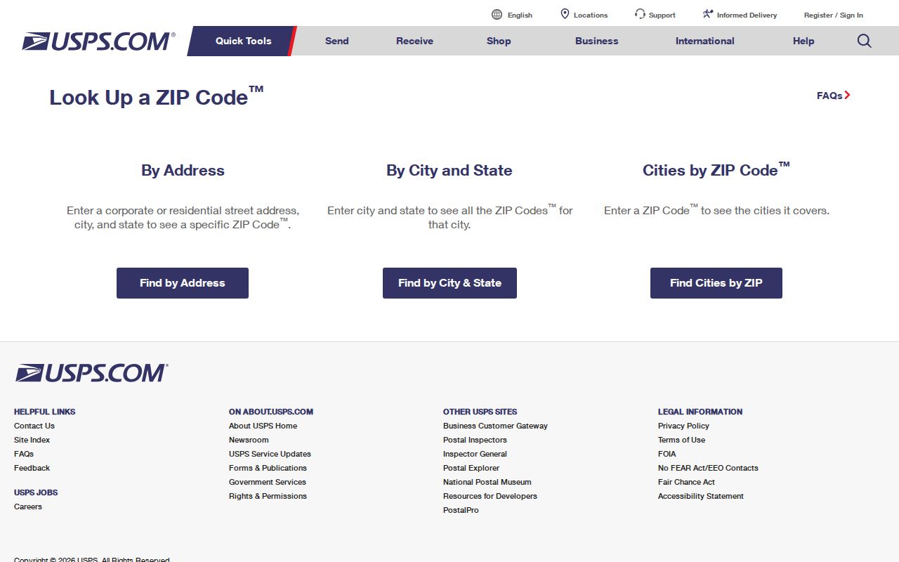
Carry the verified mailing text into the parcel search, but keep the postal city and ZIP separate from the situs and legal description.
Find Frankfort Residents by ZIP
A ZIP code directory can narrow a large area, but the official routes differ. Research found no public ZIP filter in the Franklin PVA, collector, tax frame, or OpenGov property search. The GIS service does publish a Zipcode layer. State voter data can include household ZIP output through a controlled request. The individual voter tool searches by name and date of birth, not ZIP.
- Verify the complete mailing address through USPS. Save the standardized result.
- Open Franklin County GIS and overlay its ZIP, parcel, address-point, and city-limit layers.
- Search the parcel by street address, PIDN, MAP/Parcel, or owner because the public tax screens lack a ZIP field.
- For lawful voter-list research, review SBE-84 and request household ZIP output only if the eligibility and use rules fit.
- Once a code narrows the area, use the Frankfort street directory for address-level parcel and deed work.
This sequence avoids pretending that a portal accepts a field it does not have. It also keeps postal, parcel, and voter records in their proper roles.
The OpenGov property route offers PIDN, MAP/Parcel, Location Address, Street Name, and Mailing Name. Its results can show property ID, parcel number, mailing name, location, and amount due. None is a ZIP-wide resident roster. Use a confirmed ZIP to choose the area, then use those actual fields to reach the parcel.
Overlay Frankfort ZIP and Parcels
The Franklin County GIS Viewer and its public REST service can display ZIP geography beside parcels, roads, address points, zoning, floodplain, subdivisions, districts, and city limits. This is the strongest local way to compare postal geography with the land record. Its ZIP layer is generalized, and research did not locate an official update date.
Find the subject parcel first. Then note whether its situs point falls inside the city-limit layer and which tax district applies. Roads, the Kentucky River, steep hills, and parcel gaps can make nearby mailing addresses belong to different civic contexts. GIS is a research aid, not a legal survey, so settle ownership and boundaries through the PVA, deed, and plat.
Address points and parcels also answer different questions. A point marks a known street location, while parcel geometry outlines assessed land. One parcel can have more than one structure or point. The legal description in a deed or plat is the bridge when the map and postal wording do not line up cleanly.
Postal Frankfort Exceeds City Limits
Frankfort city covered 14.77 square miles in Census figures, while Franklin County covered 207.84 square miles. The city had 28,602 residents in the 2020 count; the county had 51,541. Those figures show why a postal Frankfort line is a poor shortcut for municipal jurisdiction. USPS chooses delivery names and routes. City government and county property systems use political and parcel boundaries.
The river-valley setting adds another layer. A route can cross terrain and governmental lines without creating a separate neighborhood. Check USPS for delivery, GIS for city limits, PVA for situs and tax district, and the Clerk for the legal parcel. This profile's geography finding is the key lesson of the Frankfort ZIP code directory: the county is much larger than the city that supplies the postal name.
Boundary check. Never assign a Frankfort municipal office from the postal line alone. Confirm city limits and tax district before requesting records.
Frankfort ZIP Output on SBE-84
The State Board of Elections SBE-84 form is the documented ZIP-capable resident-record route. It can request household ZIP output along with county or precinct scope, party selections, inactive-voter inclusion, output format, and delivery choices. The requester must qualify, state the purpose, sign the oath, and follow restrictions on use and resale. The form states a processing window of seven to ten business days, while current fees need confirmation from the Board.
This is not an unrestricted public ZIP-wide portal. The Voter Information Center remains the free tool for one person's registration and polling information, using legal name and date of birth. A voter file is also a dated registration snapshot, not a complete list of every Frankfort resident in a ZIP.
Protected Safe at Home addresses, people who are not registered, recent moves, and list-maintenance timing can all explain a mismatch. Never use another roll to reverse a protected physical address. Treat ZIP output as one dated official source and verify the narrow fact needed for lawful personal or civic research.
Frankfort ZIP Is Not ZCTA
Census ZIP Code Tabulation Areas, called ZCTAs, are generalized statistical shapes. Census guidance explains that not every valid postal ZIP receives a ZCTA and that the boundary is not the same as USPS point-based delivery. Use ZCTA for population or demographic context, never to certify a mailing address.
A postal ZIP can also serve boxes or an institution rather than a distinct ground area. The inspected USPS pages did not confirm which Frankfort codes have those exact functions. The ZIP code directory therefore marks those roles as unverified instead of attaching unsupported neighborhood names.
Four Frankfort Address Keys
ZIP research works only when each kind of address stays labeled. These terms prevent a mailing result from being mistaken for residence or legal ownership.
- ZIP and ZIP+4
- The five-digit delivery area and a more exact four-digit delivery segment.
- PO-box ZIP
- A code or assignment used for post office box delivery rather than a mapped neighborhood.
- Unique ZIP
- A code assigned to one large organization or institution.
- Carrier route
- The sequence or area served by a postal carrier, which is not a city boundary.
Also distinguish situs, mailing, and legal description. Situs is the physical parcel location. Mailing is where tax or other mail goes. The legal description identifies land through lot, block, subdivision, or metes and bounds even when street text changes.
Resolve Frankfort ZIP Disagreements
When two sources disagree, send each question to its custodian. USPS settles the deliverable postal form. City or county Planning explains assigned addresses and jurisdiction. The PVA checks situs and parcel facts. The County Clerk's deed and plat protect the legal description. An open-records request can seek a specific addressing plan, permit, or dated agency record.
Historical addresses need another step. Compare city directories, Sanborn maps, plats, and the KDLA land-record method, then avoid projecting a current ZIP backward into years before it applied. Research found no official list of Frankfort ZIP enclaves or a dated citywide ZIP split, so the sound answer remains address-specific verification.
Note: A ZIP code directory narrows the search area; it cannot replace the parcel, street, and custodian records that identify the correct jurisdiction.